


Voting District 23, Custer County, Oklahoma
About
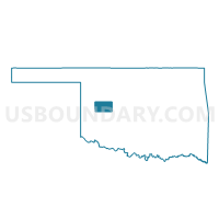
Outline

Summary
| Unique Area Identifier | 653929 |
| Name | Voting District 23 |
| County | Custer County |
| State | Oklahoma |
| Area (square miles) | 138.16 |
| Land Area (square miles) | 137.94 |
| Water Area (square miles) | 0.21 |
| % of Land Area | 99.84 |
| % of Water Area | 0.16 |
| Latitude of the Internal Point | 35.73071320 |
| Longtitude of the Internal Point | -98.74483440 |
Maps


Graphs
Select a template below for downloading or customizing gragh for Voting District 23, Custer County, Oklahoma


Neighbors
Neighoring Voting District (by Name) Neighboring Voting District on the Map
- Voting District 10, Dewey County, OK
- Voting District 12, Blaine County, OK
- Voting District 12, Custer County, OK
- Voting District 13, Custer County, OK
- Voting District 16, Blaine County, OK
- Voting District 19, Custer County, OK
- Voting District 2, Dewey County, OK
- Voting District 20, Custer County, OK
- Voting District 20, Blaine County, OK
Top 10 Neighboring County Subdivision (by Population) Neighboring County Subdivision on the Map
- Weatherford CCD, Custer County, OK (12,988)
- Watonga CCD, Blaine County, OK (6,744)
- Seiling CCD, Dewey County, OK (1,964)
- Geary CCD, Blaine County, OK (1,937)
- Thomas CCD, Custer County, OK (1,715)
- Taloga-Leedey CCD, Dewey County, OK (1,303)
- Custer City CCD, Custer County, OK (595)
Top 10 Neighboring Place (by Population) Neighboring Place on the Map
Top 10 Neighboring Unified School District (by Population) Neighboring Unified School District on the Map
- Weatherford Public Schools, OK (13,015)
- Thomas-Fay-Custer Unified Schools, OK (2,690)
- Hydro-Eakly Public Schools, OK (2,340)
Top 10 Neighboring State Legislative District Lower Chamber (by Population) Neighboring State Legislative District Lower Chamber on the Map
Top 10 Neighboring State Legislative District Upper Chamber (by Population) Neighboring State Legislative District Upper Chamber on the Map
Top 10 Neighboring 111th Congressional District (by Population) Neighboring 111th Congressional District on the Map
Top 10 Neighboring Census Tract (by Population) Neighboring Census Tract on the Map
- Census Tract 9607, Custer County, OK (7,611)
- Census Tract 9606, Custer County, OK (5,377)
- Census Tract 9610, Custer County, OK (3,356)
- Census Tract 9591, Dewey County, OK (1,964)
- Census Tract 9590, Blaine County, OK (1,937)
- Census Tract 9593, Dewey County, OK (1,303)
- Census Tract 9588, Blaine County, OK (1,220)
Top 10 Neighboring 5-Digit ZIP Code Tabulation Area (by Population) Neighboring 5-Digit ZIP Code Tabulation Area on the Map
- 73096, OK (13,037)
- 73048, OK (2,020)
- 73669, OK (1,675)
- 73639, OK (602)
- 73646, OK (384)
- 73659, OK (160)